historical overview
of Grandview Heights and Marble Cliff, Ohio

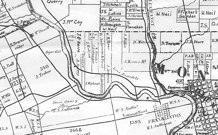
The region of the U.S. now encompassing Ohio was Native American territory before 1795, the year the coalition of Indian tribes known as the Western Confederacy (the tribes of Wyandots, Delawares, Shawanoese, Senacas and Miamies) agreed, in the Treaty of Greenville, to move west. Only a few white hunters, hardy pioneers and surveyors ventured across the Ohio River to explore its tributaries. One such surveyor was Lucas Sullivant. In the spring and summer of 1796, using Indian foot paths, his surveying party followed the Scioto River northward to where it joined the Whetstone (Olentangy) River.
Sullivant filed claim to huge tracts of land and began laying out plats for what would become his town, Franklinton, on the west side of the Scioto River. Thomas Hutchins, geographer of the United States, and John Mathews and Ebenezer Buckingham, official surveyors, platted what is now Columbus, Grandview and Marble Cliff. Lucas Sullivant was the original owner of the area, purchasing the land at the land grant office in Chillicothe from an agent of President James Madison.
The land that now is Grandview Heights and Marble Cliff was at the edge of the Refugee Tract of the Congress Lands and was included in the Virginia Militia District, which came about after the Revolutionary War. The land known as the Refugee Tract was designated for the Canadian "Refugees" who aided the American Colonists and could not return to their homes. Virginia gave up her claim to land northwest of the Ohio River in 1795 for the benefit of the union. However, if its Kentucky lands would not be sufficient to satisfy Virginia's land grants to soldiers, then lands between the Little Miami and Scioto Rivers would make up the deficiency. Thus was created the Virginia Military District between the rivers, extending north as far as their headwaters.
When Ohio became the 17th state in 1803, Franklin County extended as far north as Lake Erie. By 1816, the town of Columbus was laid out. Around 1832 many large farms in our area comprised the townships, including the one sold by Joel Buttles for a County Poor Farm. In 1842, the present Grandview Heights area was divided into 12 plots, and Lucas Sullivant sold them off. New owners included A. O'Harra, J. O'Harra and A. Sperry, who owned most of the present Marble Cliff; J. Walcutt, Levi Beardsley, R. Anderson, J. Anderson, W. H. Howe, S. Ritter, W. Mitchell, J. Morse, W. Hunter, S. Zollinger, W. Perrin, and J. Hunter claimed the region that comprised current Grandview. These were further divided into farms that were sold to other early pioneers. County roads situated at the locations of Dublin Road, Olentangy River Road, and Fifth Avenue bounded the area. By 1850, the Columbus and Xenia passenger train provided easy access to Columbus and the new region, accelerating growth here.
J. Slyh, J. H. and J. Miller and A. Wood owned the farms that became Marble Cliff. Johne E. Price and Charles Griswold purchased the western ridge along the Scioto River from what is now Fifth Avenue south to just north of what is now First Avenue. They gave the plat of land the name "Arlington". The name persisted as the name of the western settlement as it developed over the years. Early residents George Urlin, John Tilton, Fred H. Croughton and Edward Denmead bought tracts of land and laid out the streets of the future Grandview Heights. The first school in the area was established at the corner of Dublin and Grandview Avenue (unofficially called Walcutt's School because he donated the land on which it was built), and its designation was Franklin Township School.
In 1901, the entire area between the two rivers, and roughly King Avenue, became united as the Hamlet of Marble Cliff for the first and last time. Many residents wanted to retain the name Arlington for the new hamlet, but there was already a post office with the name elsewhere in Ohio. The quarries nearby were called the Marble Cliff Quarries, and it was also the name of the railroad station and post office located at Fifth Avenue and the rail line just east of the river. So concensus led to the choice of Marble Cliff. (After the new subdivision north of Fifth Avenue was developed by the Thompson brothers in 1914, it was named Upper Arlington because it was north of the hamlet, which was still sometimes called Arlington, or Arlington Place, in the press.) The Hamlet of Marble Cliff, was set up to be governed by a board of trustees, most of whom represented the north half of the hamlet. Friction developed between the north and south because of disputes over which part would benefit most from development, and who would pay the bulk of the expenses. Also, Mayor J. S. Ricketts, a minister who despised alcohol, fined revelers, including local visitors to the country club that was in the southern section.
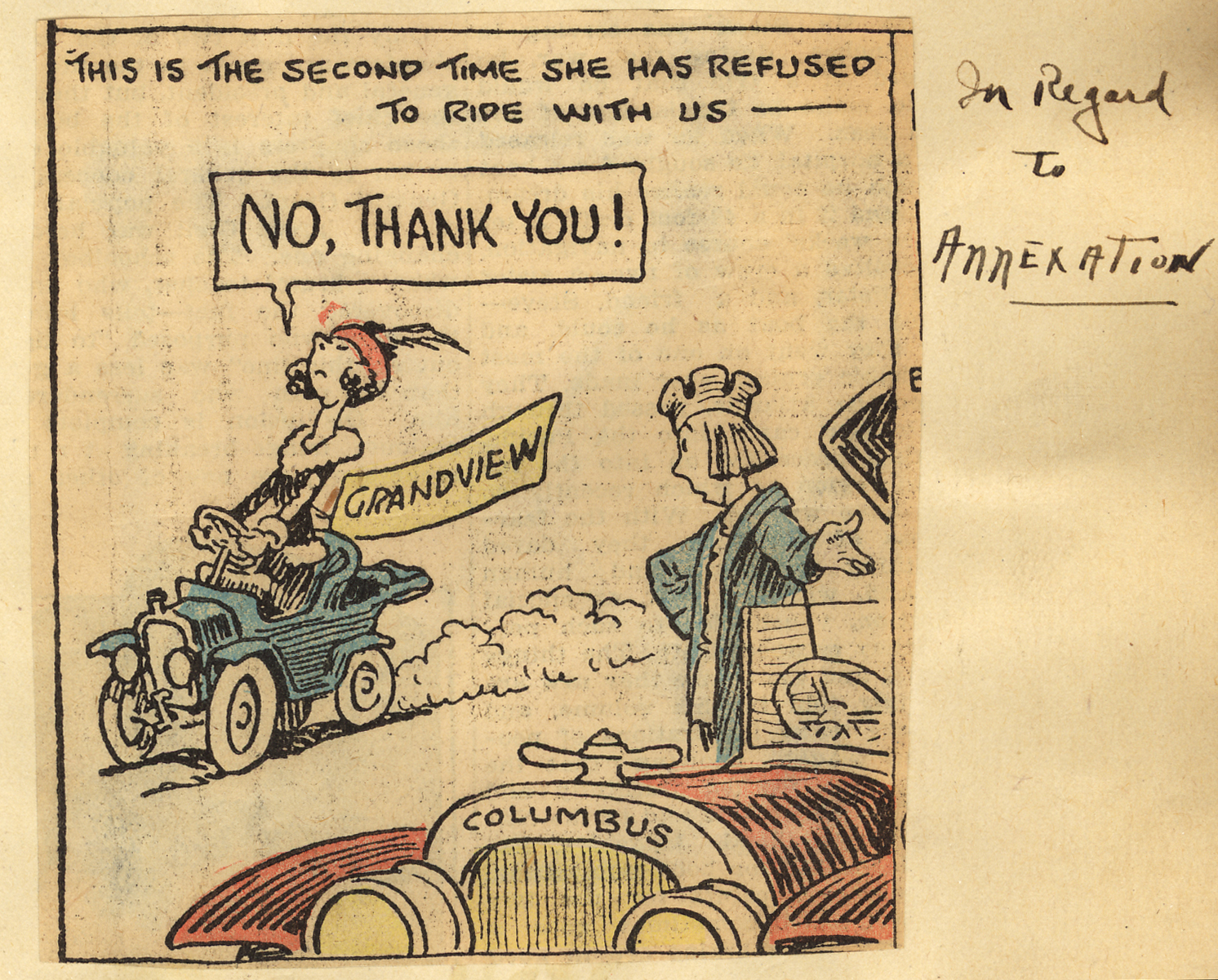
The southern residents took advantage of a new State law, and in January of 1903 they were allowed to detach themselves from the hamlet. Later Marble Cliff voted to surrender its municipality. The territories that withdrew were Arlington, Grandview and Chester Heights. Many discussions of annexation by Columbus followed this action, and the now 200 residents asked for water and electricity. When they were denied, they voted in 1906 to incorporate as the Village of Grandview Heights.The first Grandview Heights village council included S.C. Jones as President, and C.F. Butterworth as Clerk. Butterworth was later appointed the first Village Marshall. Julius Stone also served on the council. Mayors after Jones included James T. Carman in 1912, C. K. Seibert in 1916 and John Ryder from 1918 to 1940. After watching the early success of Grandview, the remaining section of the old Hamlet of Marble Cliff voted in 1908 to also incorporate as a village. They were courted in 1925 to rejoin Grandview but chose to stay independent.
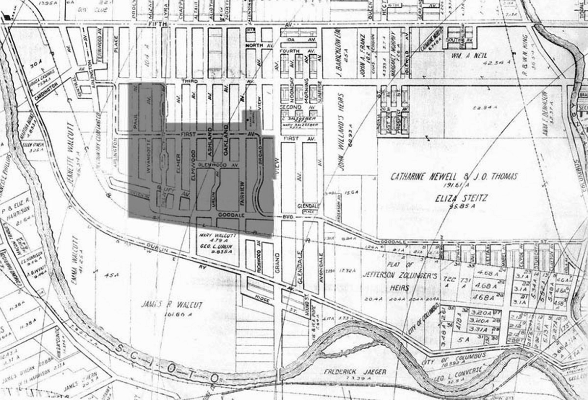
The 1906 Grandview Heights included both sides of Lincoln Rd. (then Paul Avenue), andthe northern boundary went east on a line with Third Avenue to the center of Glenn Avenue. It turned south and ran east along the north edge of the lot lines of houses facing West First Avenue to Fairview. It included the future Edison School and the Harding School tracts going south to the center line of Broadview at First Avenue, then east to the center line of Grandview Avenue, and hence south to a distance just below the railroad tracks, returning west to the Marble Cliff corporation line.
In 1911 Grandview began what was a sequential annexation of land that was developed as subdivisions, adding Wyandotte and Lincoln Roads from Third to Fifth.
 Later that year they annexed the entire block on which the schools are located, Grandview from Third to First, and Glendale and Avondale from First to the railroad. The next year they added Wyandotte and Lincoln from First to the railroad, and then moved east over the next few years to the present boundary. In 1921 the residents rejected for a second time an attempt by the City of Columbus to annex the suburbs of Grandview and Marble Cliff. A third annexation question was rejected in 1931, the year Grandview was chartered as a city.
Educational institutions were important to the Tri-Village (Grandview Heights, Marble Cliff and Upper Arlington) residents. The Harding School was built in 1895, Edison east 1911, Edison west 1922, Grandview High School in 1923 and the Robert Louis Stevenson School in 1926. The Grandview Heights Public Library was established in 1924. The Grandview Avenue Bank Block, one of the first of its kind, was constructed in 1927.
In 1920, the whole area presented a quiet, sedate appearance. After World War II there was a growth spurt that saw many multiple family units built. Industry and shopping centers arose. After Grandview became a city in 1931, it did not lose its small town charm. It remained the same in many ways. There is still a close-knit feeling and neighborliness among the people, and few neighborhoods in a city have remained so delightfully unspoiled for nearly a century.
